Progress Monitoring Made Easy: Drones in Weekly Construction Reporting
Introduction
Keeping track of progress on construction sites is vital. Without clear updates, delays happen, costs rise, and clients get impatient. Traditionally, teams relied on manual site visits and paper plans, but those methods come with problems. They can be slow, prone to errors, and sometimes unsafe.Thankfully, new tech is changing the game. Drones now make it easier to see what’s happening on-site every week. These flying tools can quickly capture detailed images and videos, saving time and improving accuracy. Using drones means faster reports, safer procedures, and better control of the project timeline.

The Rise of Drones in Construction Progress Monitoring
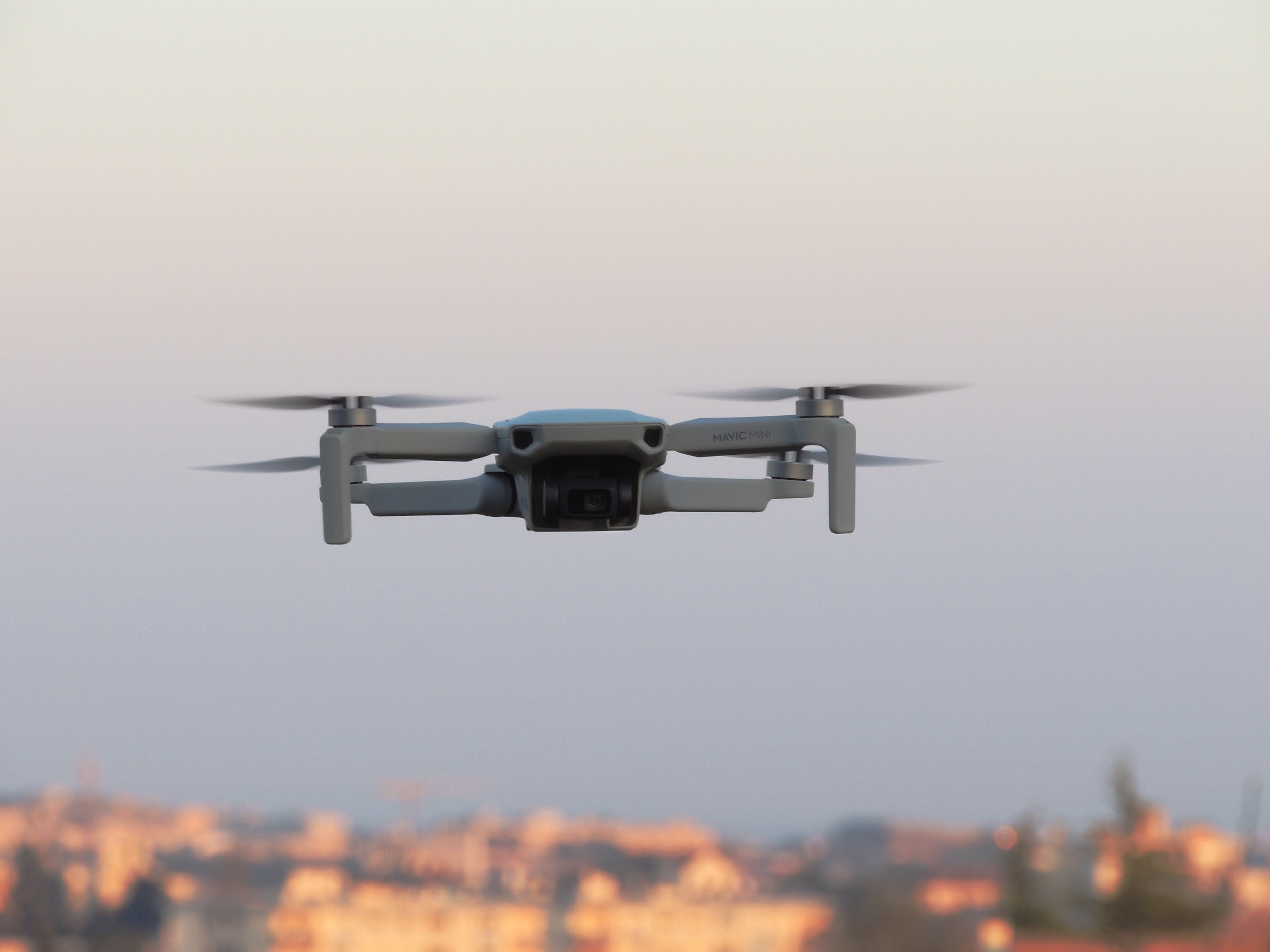
Overview of Drone Technology in Construction
Drones started as hobby devices but have quickly become essential in construction. They fly above sites and gather high-quality photos and videos. Modern drones feature high-resolution cameras, GPS, and even 3D mapping abilities.For construction workers, this means having real-time data at their fingertips. Instead of waiting days for ground surveys, teams get instant, detailed visuals. This all leads to smarter decision-making and faster problem-solving.
Benefits of Using Drones for Weekly Reporting
Using drones for weekly progress checks offers many perks:
- Greater accuracy: Overhead images show true pictures of work done.
- Time savings: What used to take hours now takes minutes.
- Enhanced safety: No need for workers to climb or walk dangerous areas.
- Better documentation: Visual records help track changes over time.
- Cost savings: Fewer site visits reduce expenses.
Some case studies show drone use can cut reporting time by up to 50%. Companies like Skanska and Bechtel report quicker project updates and fewer errors by relying on drone data.
Industry Adoption and Trends
More construction firms are jumping on the drone bandwagon. Recent surveys reveal that over 70% of large contractors now use drones at least part of the time. Bigger projects tend to see more drone integration because of the clear benefits.Major companies are even creating their own drone programs, collecting weekly data to stay on top of schedules. This trend isn’t slowing down. As technology becomes cheaper and easier to operate, expect drone use to become a standard tool in project management.
Setting Up Drone Operations for Weekly Construction Monitoring
Planning and Compliance
Before flying, you must follow laws. Get permits if needed and stay within local rules. Always check airspace restrictions, especially near airports or sensitive sites. For safety, create site-specific guidelines. Keep workers clear of drone flight zones and ensure everyone knows what to do during flights. Having a safety plan protects your team and makes operations smooth.
Choosing the Right Drone Equipment
Pick drones that fit your project size and needs:
- Camera quality: Look for 20 MP or higher for clear images.
- Flight time: At least 20-30 minutes per battery charge.
- Ease of use: Choose models with simple controls and GPS features.
- Durability: Rugged designs survive tough weather conditions.
Popular models include DJI Phantom 4 Pro, DJI Mavic 3 Enterprise, Autel EVO Lite+, and Skydio 2+. They’re reliable, support high-quality imaging, and are easy to operate by your team.
Establishing a Weekly Routine
Consistency is key. Pick a specific day for all drone surveys each week. This keeps progress updates comparable. Define team member roles — someone to pilot, another to handle data processing, and a coordinator to manage schedules. Regular routines boost productivity and ensure no critical data gets missed.
Executing Effective Weekly Drone Surveys
Pre-Flight Preparation
Before every flight, check the weather. Clear days with little wind are best. Make sure batteries are fully charged and equipment is clean. Scout the site for obstacles like cranes or power lines.Create a flight plan covering all critical areas. Decide on the flight path and altitude to ensure full coverage. Logging this plan in advance saves time and avoids surprises.
Conducting the Drone Flight
Start with a steady takeoff. Fly along pre-set paths to capture overlapping images. Keep the drone steady to get sharp visuals. Use automated flight modes if available for consistency.Make sure to gather enough data for accurate maps or 3D models. Take extra shots of problem zones or areas with new changes.
Post-Flight Data Processing
After the flight, download images and videos immediately. Use software like DroneDeploy, Pix4D, or Autodesk to process data.
- Image stitching creates detailed orthomosaics.
- 3D modeling shows site changes over time.
- Export reports with visual overlays, timelines, and annotations for stakeholders.
Fast processing leads to quicker reporting, so stay organized.
Analyzing and Utilizing Drone Data for Progress Reports
Creating Clear, Actionable Reports
Make reports easy to read. Include high-res images, maps, and graphs. Highlight completed work, delays, or problem areas.Use a consistent format so team members quickly understand progress. Label images and add comments to clarify issues or milestones. Keep reports concise but informative, focusing on what matters most.
Highlighting Delays and Issues
Look for areas where work lags or safety concerns appear. Drones make spotting these problems quick and simple. Urgent issues should be flagged immediately, allowing quick correction.Share these insights promptly to prevent delays from escalating. Clear visuals combined with direct notes help everyone act fast.
Integrating Drone Data into Overall Project Management
Most project management tools like Primavera or Procore support adding images and data. Upload drone visuals to give full picture updates.Sharing weekly reports with all teams builds transparency. When everyone sees progress and problems, coordination improves, and delays decrease.
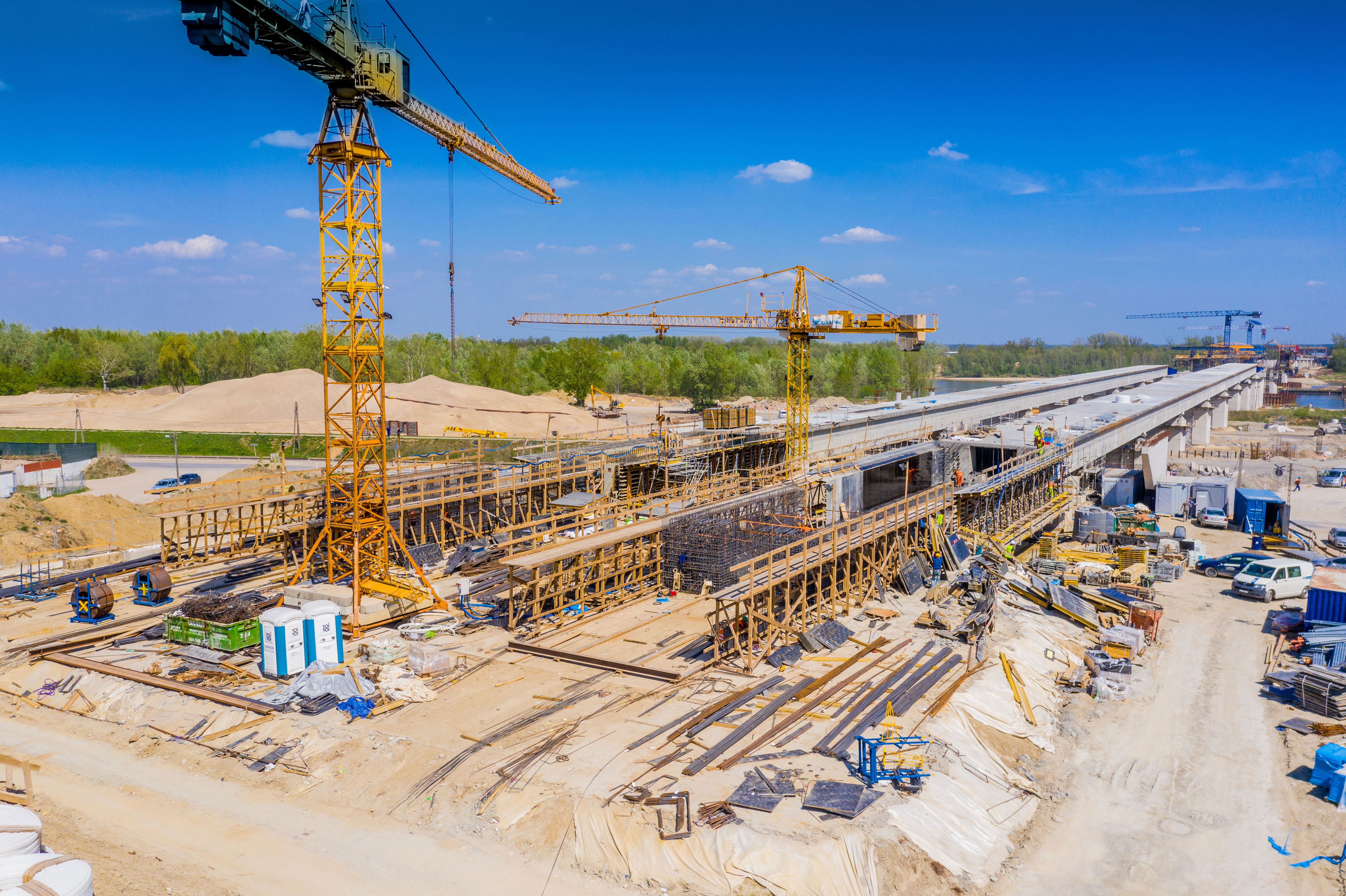
Real-World Examples and Case Studies
Successful Drone-Based Weekly Reporting Implementations
Skanska used drones to monitor a major bridge project. Weekly flights revealed minor issues before they became costly delays. As a result, the project kept on schedule and within budget.Bechtel incorporated drone surveys into their routine. They cut inspection times in half and avoided safety hazards by minimizing ground visits.
Lessons Learned from Industry Leaders
Early adopters found that training drone operators is crucial for consistent, quality data. Also, investing in user-friendly software speeds up analysis. Remember, regular use builds confidence and improves results every week.
Conclusion
Drones are transforming how construction projects track progress. They provide fast, accurate updates that help teams catch issues early and stay on schedule. The time and money saved are too good to ignore.Start small: plan your first weekly drone survey, choose reliable equipment, and set routines. As you grow familiar with the process, you'll see the benefits unfold.Adopting drone technology allows you to monitor construction progress with ease and confidence. Don’t wait—integrate drones into your weekly reporting process today and watch your projects run smoother.
At SkyData, we specialize in drone-based aerial data capture for construction progress monitoring, mapping, and inspections across New Hampshire and New England. Our team delivers consistent, high-quality visual reports on a weekly (or custom) schedule, tailored to your project needs. Whether you're building a single site or managing multiple developments, we help you track progress with confidence. Need better visibility from above? Let SkyData handle the sky so you can focus on the build.
📩 Contact us today to schedule a FREE consultation.